Backyard History, Kiah House

Happy 108th Birthday, Virginia Kiah!

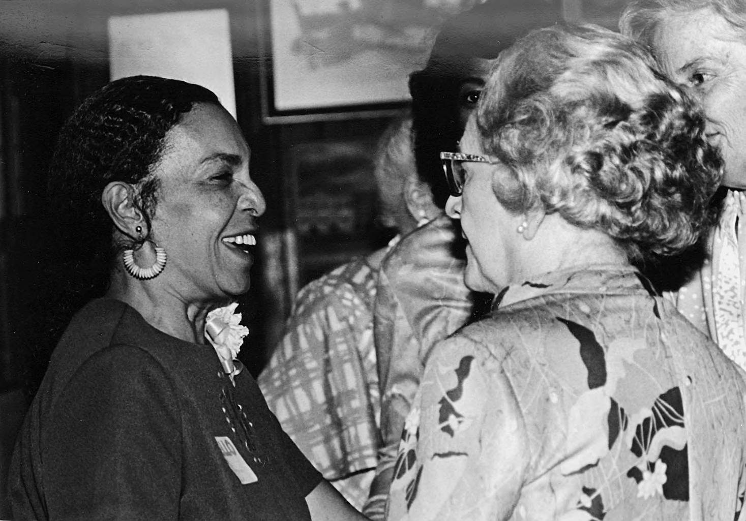
To celebrate Virginia Kiah’s 108th Birthday and kick-off renewed efforts to memorialize her legacy, we are hosting a series of events leading up to June 3rd, Mrs. Kiah’s birthday. The “we” of this are: Friends of the Kiah House Museum, Center for the Study of African and African Diaspora Museums and Communities (CFSAADMC), Historic Cuyler Brownsville Neighborhood Development, Inc., and Savannah Archaeological Alliance. Please feel free to attend all or some of the events. If you can’t attend, consider buying a t-shirt to support the cause. Money from the t-shirts will go towards a Kiah House historical marker.

Caring for Creation: “Art is in Everything”

A Birthday Celebration for Virginia Kiah, Kiah Museum Founder

Caring for Creation Then and Now:

Georgia Black Museum and Black Folk Remedies Exhibition

Friday May 31, 2019 Exhibit Reception, 4-7pm

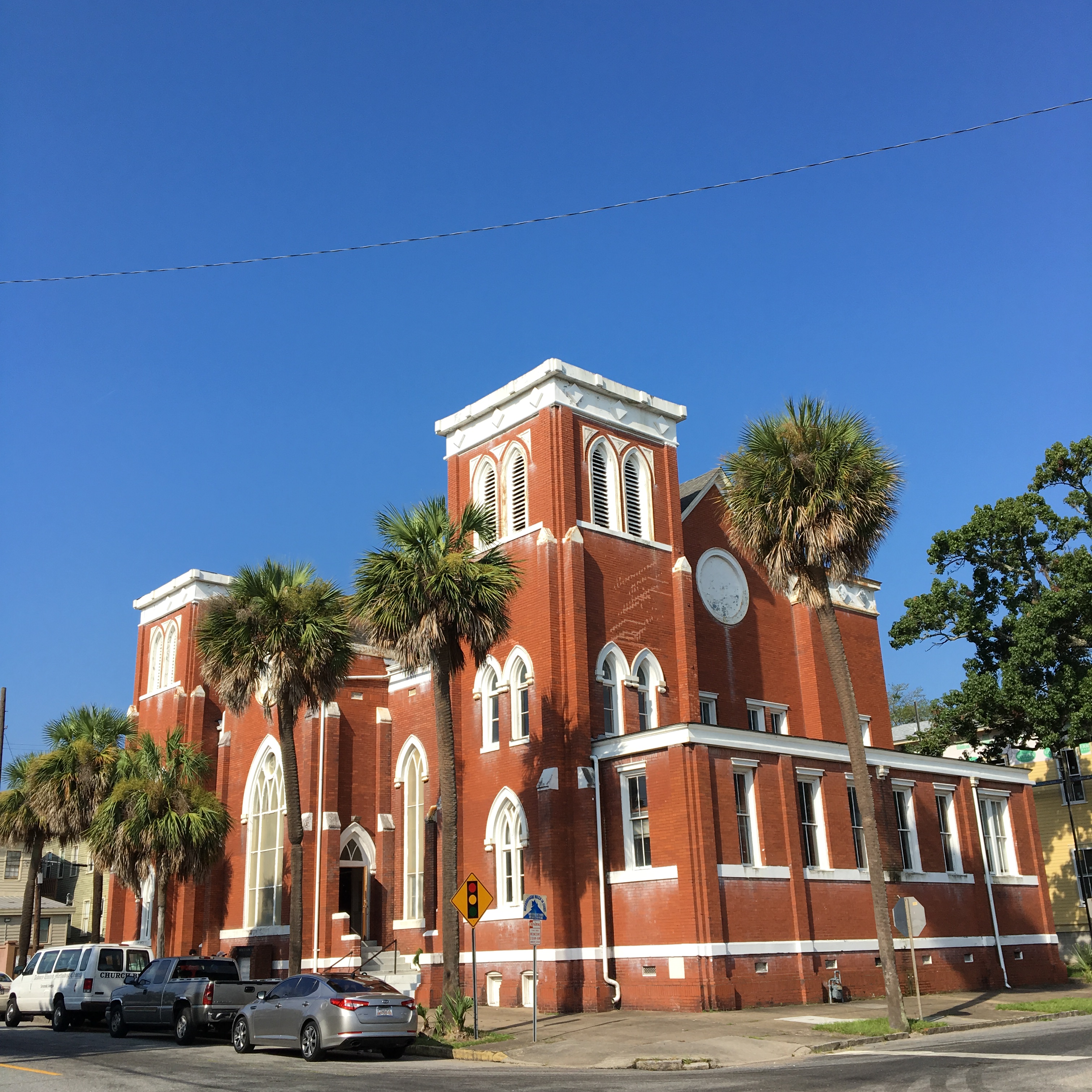
Savannah State University, Social Sciences Building‘s Social Science Gallery

Exhibit runs June 1- June 30, 2019

About the Exhibition: Savannah State University students from the Introduction to Anthropology class and CFSAADMC members’ research of Georgia Black Museums in partnership with the St. Joseph’s Candler African American Health Center project on Black Folk Remedies present their results in an exhibition featuring the ethnographic fieldwork of students and others to collect the oral history home remedies among African American Families in the Georgia Low Country. Also learn about the proposed Museum Administration Certificate Program.

Exhibition Curator (s): Tina Hicks, Ella Williamson (AAH) Black Folk Remedies, Dr. Deborah Johnson-Simon- SSU Anthropology

Contact(s) Otilia Iancu -Director MPA at SSU, iancuo@savannahstate.edu 


Caring for Community Cultural Heritage:

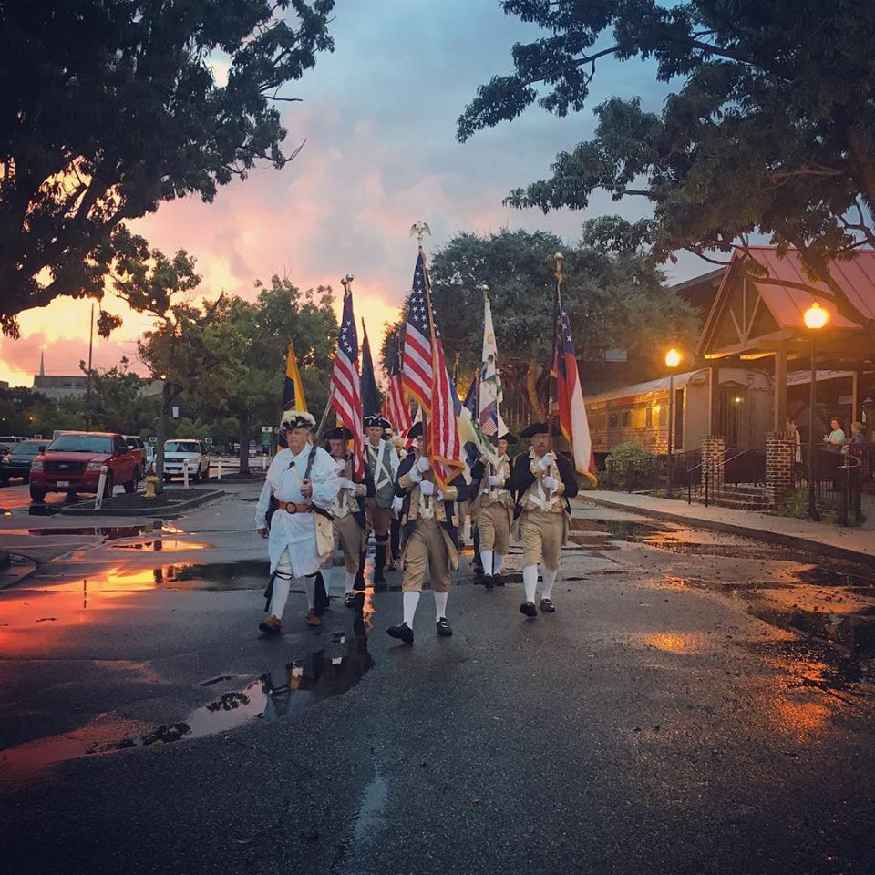
Cuyler-Brownville Living History Walk

Saturday, June 1, 2019, 10:00 AM- 3:00 PM

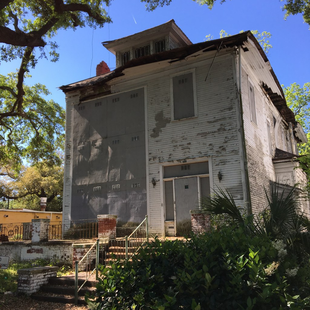
Join us on a walking tour of Cuyler-Brownville’s historic sites, including Dr. & Mrs. Virginia Jackson Kiah’s home and museum, followed by picnic in Floyd “Pressboy” Adams Park (32nd and Cuyler Streets). The walking tour will begin at 10am at the park and end in the same location. The walk will help show community support for a historical marker.

Contact(s):

Jan Fox – Historic Cuyler Brownsville Neighborhood Development, Inc.

Laura Seifert- Savannah Archaeology Alliance (SAA)

Youth Organizers

Essence Irvin

Shanell Byfield


Caring for Church Religious Heritage:

Worship at Asbury United Methodist Church

Sunday, June 2, 2019 at 11AM

Contact(s): Pastor Debora Shinholster Richards, (912) 236-4792

Organizers: Juanita Tucker, Carolyn Fletcher, Vincent Hamilton

1201 Abercorn Street, Savannah, GA 31401

Come and worship at the home church of Dr. Calvin and Virginia Kiah. A program insert is being prepared with collected birthday wishes a special memories of Mrs. Kiah.  Also, a handout of her favorite song that can be taken by those attending the service who want to go with the Friends of the Kiah Museum to wreath-laying at the gravesite. Mr. Vincent Hamilton, former student of Mrs. Kiah and Asbury Lay Leader has been asked to officiate the gravesite ceremony.

The Gravesite Visit and Wreath Ceremony is at Hillcrest Abbey East, 1600 Wheaton St, Savannah, GA, immediately following morning worship.


Image from https://www.savannah.com/savannahs-history-beach-institute/

Caring for Family and Ancestor Knowledge:

Genealogy Research Support Center (GRSC) at the Beach Institute and Cultural Center 

Monday, June 3, 2019, 10:00 AM-3:00 PM

Genealogy Workshop

Contact(s): Ron Christopher, 502 Harris St, Savannah, GA 31402

Finding Family – How Hard Can It Be?

Historic Savannah Church Historians and Family Historians, You’re Invited! It’s a time for caring and sharing your family stories and learn about the newest place in town that wants to care for your family stories from Savannah and throughout the African Diaspora. Schedule for the workshop is forthcoming.

Workshop experts include:

Genealogy Specialist- Mrs. Dorothy Tuck, (Celebrated Researcher of Megan Markel Georgia Ancestry) Genealogical Society of Henry and Clayton Counties-The Brown House, McDonough, GA

Amir Jamal Touré, J.D., a professor at Savannah State University (SSU) in the Africana studies program.

Library Specialist – Sharen Lee, Bull Street Library Genealogy Room Savannah, GA

Dr. Alena Pirok– Public Historian GSU-Armstrong Development of Free and Enslaved People of Savannah Database

Backyard History, public archaeology

Graves in the Airport Runway

Have you ever seen two gray rectangles distinct from the surrounding gray of the Savannah airport runway? A friend’s Facebook post of the Dotson Runway Graves led me to several articles on this oddity. In short, as the Savannah Airport expanded into the surrounding farmland, it took over a family cemetery as well. Many of the graves were exhumed and the bodies reburied in another cemetery, but per the family’s wishes, Richard and Catherine Dotson were left in place. According to the Atlas Obscura article, “Citing the fact that their ancestors would have wanted to stay on the land they worked so hard to cultivate and purchase, the surviving Dotson relatives refused to allow Richard and Catherine to be moved.” So the runway was built around them and the graves given new markers.

The Dotson graves. The picture is from the Atlas Obscura article. I suspect it’s a Google maps or Google Earth capture, since we can’t walk out on the runway to take photographs.

While this may seem like a bizarre story, these are exactly the type of problems and solutions archaeologists face everyday. Most archaeologists (probably around 80%) work in Cultural Resources Management (CRM). This means they don’t work in academia or in museums but work for archaeology companies or in government. CRM essentially began in 1966 with the passage of the National Historic Preservation Act. This federal law mandates archaeology and historic preservation for projects with certain conditions:

  • projects on federal land or in federal waters (like National Parks or the White House front lawn)
  • projects involving federal permits or federal money (like the Savannah Harbor Deepening)

But the laws do not mandate how the archaeology is done. In fact, the law only requires that the project managers “consider impacts” to cultural resources eligible for the National Register of Historic Places. Of course, I am radically simplifying a complex process. My point is that archaeologists do more than dig. Archaeologists and their cousins (such as historic preservationists) manage archaeology sites and cultural resources to find solutions that work for the most number of stakeholders: the project developer, descendants, businesses, neighbors, etc. To do so, they often mix many techniques like “consultation with stakeholders”. In the case of the Dotson graves, it was the descendant family members whose ancestors’ graves were disturbed. In other cases, such as the CSS Georgia ironclad, the Army Corps of Engineers represented the military’s constituency, since the Confederate Navy no longer exists.

Barge over the CSS Georgia. From this platform, archaeologists recovered artifacts and pieces of the ironclad for study and preservation.

Most importantly, cultural resource managers need and want your input on projects. Resources on public lands belong to all of us, and we are all stakeholders to varying extents. The CSS Georgia project was much more successful than others in sharing the project with the public. The CRM firm, Panamerican Consultants, Inc., hired an archaeologist specifically to do public outreach, resulting in the Raise the Wreck festival. A documentarian was hired, the CRM company head Steve James spoke to my students at Armstrong, and much more. We need to demand that more projects follow this model so this becomes the norm and not the exception.

Backyard History

Hull Park: Backyard History

Recently on three separate occasions, people spontaneously shared their personal Hull Park history. Twice, it was grandfathers watching grandchildren at the playground and baseball diamond, and once it was a City of Savannah employee who manages the park. This week, a gentleman told me that while the city has replaced nearly every piece of playground equipment over the years, the merry-go-round is the original. He said, “I’m 66-years-old. I got hurt on that merry-go-round. My daughter got hurt on that merry-go-round…” He trailed off but smiled and shook his head as he watched his granddaughter hang off it and spin around crazily.

IMG_3713
The venerable Hull Park merry-go-round

The Ardsley Park/Chatham Crescent Neighborhood Association’s website gives a quick history:

“By the 1930’s, development of Ardsley Park and Chatham Crescent was nearly complete. The [Developers] Lattimore’s then set out for their next development, Ardmore. Running from 52nd Street to 55th Street to the South, and punctuated with a large, diamond shaped Hull Park, Ardmore would also become a popular Savannah neighborhood. On Sunday, November 8, 1925, a full page ad in the Savannah Morning News reported the public sale of lots in Ardmore.  The day after the sale, it was announced that every lot had been sold before noon the same day.”

I also found a great little video on the neighborhood’s history produced by the City of Savannah and featuring one of my favorite people. I love histories written with multiple layers: the practical details about time frames and architectural styles mixed with personal stories about the residents’ lives.

IMG_3717
View of Hull Park facing north with recent playground equipment (foreground) and the baseball diamond in the distance.
Backyard History

Backyard History: Tybee Lighthouse

My three-year-old insisted on going to Tybee today. He’s had worse suggestions, so we went and had a few relaxing hours on the beach. Me reading, him playing with his toy dump truck and loader. I haven’t taken my son up in the lighthouse yet, mostly because I think that will end in me carrying him. It’s a lot of stairs.

IMG_3513
Tybee Lighthouse from the beach.

James Oglethorpe had a navigational marker placed on the property now housing the lighthouse in 1733, the same year he founded Georgia. A lighthouse has stood in this area ever since. By 1736 Noble Jones, Georgia’s surveyor, supervised the construction of a 90-foot wooden tower, although it did not have a light. This daytime navigation marker was the largest on the British-controlled east coast. In 1741, a storm destroyed the tower.

A second, 90 to 94 foot lighthouse was built by 1742. It too did not have a light. An associated Keeper’s House was also built nearby. This lighthouse was gone by 1768, a victim of the harsh coastal elements. The third lighthouse was built in 1773 and destroyed by fire in 1791. The current lighthouse, a 100-foot, octagonal-base brick lighthouse, was built in 1791, probably on the foundation of the 1773 building. Note: the Tybee Light Station is a museum today; entry fees apply.

The Assistant Keeper’s House was restored in 2003. Since the restoration included some ground-disturbing activities, the Tybee Island Historical Society, which runs the Light Station and the Tybee Museum, called in archaeologists to make sure they weren’t destroying historic resources.

Archaeologists examined two corners the brick foundation beneath the existing, circa 1885 house. They excavated two test units (square areas that were dug out), finding nearly 5,000 artifacts in their small excavation. Artifacts recovered included architectural materials like brick, mortar, and window glass; kitchen ceramics, bottle glass, and tin cans were also discovered. Food remains showed the dietary variety: turtle, beef, pork, foul, fish, and eggs were eaten on site. Shellfish were also an important part of the diet including oysters, clams, crab, and whelk. Personal artifacts were found as well: a brass finger ring, pocketknife fragments, a glass marble, mirror glass, newspaper scraps, matches, and a piece of engraved slate. Bullets and other armament artifacts were found as well as uniform buckles and a brass insignia. Many of these are probably from the Civil War soldiers camped near the lighthouse.

The brick foundation under the current house is the footing for an earlier keeper’s house. A brown transfer printed sherd (ceramic fragment) was found in the foundation’s builder’s trench. Brown transfer printed ceramics were first made in 1809, so the building must date after 1809. The historical record states this circa 1809 house burned in 1885. Melted window and bottle glass were found with exploded bricks and highly tempered (heat-treated) nails. When iron is heated to extremely high temperatures, the nails are preserved and rust-free.

Artifacts from the 1700s were also found, so an even earlier building was also probably on this site. While no structural remains were found for an earlier building, an undated brick hearth and chimney pad were found, possibly from this 1700s era building.

Backyard History

Backyard History: Daffin Park

A neighbor was recently lunching in Daffin Park and found an 1883 Liberty Penny lying on the surface. His excited Facebook post showed how important local history, and especially tangible artifacts, are to us. Archaeologists vary on how excitable they get when non-archaeologists take artifacts. Legally speaking, taking any artifact from someone else’s property is stealing. However, some archaeologists acknowledge that one or two artifacts taken from a surface context (aka no digging*) probably won’t seriously damage a site. Of course, on public property, if everyone takes one or two artifacts, this can add up.

daffin liberty penny
1883 Liberty penny from Daffin Park

Designed by John Nolen, Daffin Park was founded in 1907, completed in 1909, and is part of the Parkside Place Historic District. The Beaux Arts-inspired Daffin Park is named after Philip Daffin, the first Chairman of the Savannah Park and Tree Commission. The park has always been designated for athletic pursuits, from the professional to the amateur. Grayson Stadium, built in 1941, replaced the older 1930s Municipal Stadium. Grayson Stadium encroached on Herty Park, which retains its original character as a pine grove, but today is also a dog park. The stadium also altered the park’s larger structure by eliminating the eastern circular drive. The east-west central roads have two live oak-lined allees creating a 210-foot-wide central mall that connected the two circular drives and four diagonal roads that lead to each corner of the park.

Daffin map
Google Maps snapshot showing how the park’s west end has been altered by Grayson Stadium, leaving the park less symmetrical than the original.

Athletic fields north and south of the mall are still intact today, as is the children’s playground at Waters and Washington streets, albeit with updated playground equipment. Originally the southern open fields were occasionally used an a land strip for small planes. In addition to the open fields, today the park has specific areas for beach volleyball, tennis, basketball, and fishing. (Yes! There are fish and turtles in the lake). The present in-ground pool replaced an earlier, less formal pool. Tom Barton wrote, “The lake that fronts Victory Drive has its own mini-history. The original wet spot was created in the shape of the 48 contiguous United States. Years ago, kids would sneak into the lake and avoid paying a nickel for a required, pre-dip soapy shower [before entering the whites-only pool]. Bathers could rent suits as well – which explains the soapy showers.”

Daffin-Park pool
Photograph of the Daffin Park Swimming Pool, 1905. From the Edward Girard Photographs collection, MS 1374. Source: Georgia Historical Society

Robin Wright Gunn recalls the park in the early 1970s, “Sometime during that era I recall several instances of riding in the back seat of the car, Mom at the wheel, as we rolled past the corner of Victory Drive and Bee Road, the location of Daffin Park, a somewhat neglected section of the unremarkably landscaped public facility. At some point in this period, less than a decade after Daffin Park was center stage for two racial desegregation lawsuits, this corner of Daffin became known as “The People’s Park,” the unofficial gathering place for Savannah’s hippies.” She writes about her attempt to find anyone who admits to visiting the park regularly during this time, possibly because of the recreational drug use then associated with the park. “Pot was everywhere, and heroin was easy to find. Perhaps it’s that hardcore reputation that has made it difficult to find people willing to talk about this slice of local history,” wrote Gunn.

7712e50d3031d2e12a9d99a07f2e6660
The mall with its live oak allée at Daffin Park’s center.

Today the park is beautiful as ever and is always full with people engaged in all forms of recreation. So let’s go fly a kite!

IMG_3443
Kite flying on the football fields.

*It is illegal to dig on public property.


Sources:

Daffin Park-Parkside Place Historic District National Register of Historic Places Registration Form. Download a copy here.

Stewart Poit, personal communication

Dr. Robin Williams, personal communication

Savannah Morning News, February 13, 2007, Tom Barton: “Daffin Park is everybody’s backyard

Connect Savannah, January 2, 2008, Robin Wright Gunn: “Hippies in Daffin: Where were you in ’72?

Alliance series, Backyard History, public archaeology

October 9, 1779: Backyard History

October 9, 1779, is the anniversary of the Battle of Savannah. Most people don’t know there was a major Revolutionary War battle in downtown Savannah. At 800 casualties, this is considered one of the bloodiest battles of the American Revolution. However, only approximately 50 of these were British. We lost. Badly. The British held Savannah until the war’s end.

Archaeology has contributed to to our knowledge of this event. The Coastal Heritage Society manages a small, but critical, portion of the battlefield, Battlefield Memorial Park. In 2005, the park was scheduled for rehabilitation and a make-over. Archaeologist Rita Elliott asked for one last chance to find the redoubt, or small fort that the Americans and their allies attacked in an attempt to retake Savannah. She was successful, and Rita’s findings were incorporated into the reconstructed redoubt, memorial stones, and interpretive signs throughout the park. This work was also the catalyst for two National Park Service American Battlefield Protection Program grants, starting in 2007. I was fortunate to be part of the “Savannah Under Fire” project team, who extended the excavations throughout downtown Savannah’s greenspaces, finding more intact pieces of the battlefield.

Archaeologists are often criticized for being “elitist” and not sharing artifacts or knowledge. Especially for this project, that cannot be farther from the truth. In addition to the signs on Battlefield Park, there is an exhibit in the Savannah History Museum next door, where you can see the artifacts recovered from the battlefield. The project’s social media is still floating around including this brochure and (my favorite) a video of us in the field. The technical reports for all phases of the project are available as free downloads on the LAMAR Institute website:

(While there, you can also look at more than 200 other archaeology reports from Georgia and the Southeast.)

Finally, today, and every October 9, the Coastal Heritage Society holds a Battlefield Memorial March. I attended several years under obligation as an employee but was always impressed by the event and its significance.

October 9, 2018, Battlefield Memorial March. Photograph courtesy of the Coastal Heritage Society Facebook page.

I urge you to explore your Backyard History, our Revolutionary War battlefield. There is so much more than I could possibly cover in one blog post. Battlefield Memorial Park is a great place to start.